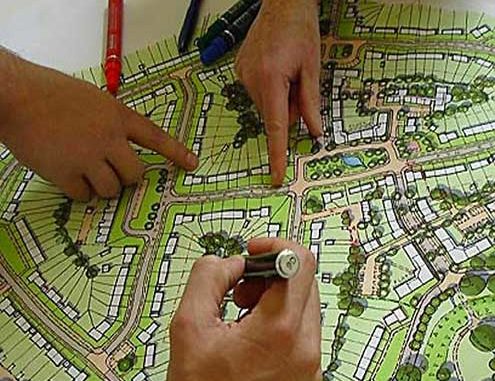
What is Urban Planning: Overview
Urban Planning: The unprecedented growth of metropolitan cities in the country has become a source of serious concern to Government, on the one hand, and metro-city corporators, planners, demographers and social scientists, on the other. The Census 2001 reveals that the number of million-plus cities has almost tripled over the last three decades, jumping from a mere 12 in 1981 to 23 in 1991 and 35 in 2001. Interestingly, the aggregate population of these metro cities accounts for more than a third (37.81%) of the country’s total urban population, which is spread over more than 5,000 towns.
It, therefore, goes without saying that these 35 metro (or million-plus) cities should be the focus of a sustained, country-wide effort to regulate and contain runaway urban growth by channelizing the flow and direction of economic growth (on which the urban phenomenon feeds) along with more balanced and spatially-oriented paths. One of the reasons for this uncontrolled growth can be attributed to the lack of Urban Planning Colleges in India. This is essentially what the National Capital Region (NCR) Planning Board is attempting to do with respect to the National Capital City.

The prime purpose of city planning is the coordination of many separate functions. This coordination calls for men holding general knowledge of the many elements.
Don’t Miss: Efficient Time Management for Students: Need and Ways
Also See: How to Increase Your Mind Power and Concentration
What Urban Planning helps to achieve
- The promotion of accessibility of homes to work, shops, schools, and entertainment of industries to sources of labour, power and raw material.
- The employment of resources as economically as possible so as to achieve to the greatest possible measure of improvement with necessary accessibility, limited means (limited resources).
- The separation of incompatible land uses (hostel and residential area) from each other and association of compatible and mutually helpful by means of land use planning.
- The carrying out of all development in an as mutually pleasant manner as is practicable.
- To balance competing interests in the use of land to ensure an overall outcome that is in the public interest. (Competing interest includes– govt. Interest, professional, developmental interest, public works, research, association of disadvantage to groups). Balancing various land uses activity system carried out by individual/ agencies.
- To ensure the provision of public goods including the infrastructure or actions that create positive neighbourhood effects. If the markets will not generate because such activity cannot be rewarded through the market. For e.g., the returns in investing in public infrastructure is lower than private infrastructure, like sewerage vs. Stock market, toll roads by private investor.
- To minimize the adverse ‘neighbourhood effects’ created by market in land and development.
- Coordination to contribute to the coordination of resources and development in the interest of overall efficiency of land use.
- Public participation to ensure that the view of all groups included in the decision making process regarding land and development.
- To identify needs (survey)
- To legitimate the proposal.
- To create a good environment for e.g., in terms of landscape, layout or aesthetic of building that may not result from market process.To control and reduce uncertainty and to ensure short term advantages do not jeopardize long term community interest.
- To influence the locational decision regarding land uses and development in order to contribute to the redistribution of wealth. For e.g., charging H.I.G and L.I.G and M.I.G. and an example of spatial inequality of slum/ squatter.To improve the information available to the market for making its locational choices.
Various advantages of Urban Planning

- Makes for purposeful and orderly activities. A person running in circle as opposed to a person running in a straight line has lesser planning since he covers no distance.
- Point out need for future change. To avoid entropy or the tendency to let things run down.
- Planning also allows us to awaken to new opportunities and visualize new possibilities.
- Planning allows us to answer what-if questions.
- What would happen to our employees if we automate the production lines?
- What would happen to our budget if we called in bonds?
Models could be built to give answers to these questions.
- Planning provides a basis for control for the production of built environment. Deadlines are determined for the start and completion for each activity, and standards of performance are set.
Planning has two primary instruments
- Development controls.
- Development plans.
Planning encourages achievement. Planning provide planners guidance and a desire to achieve results.Reduces random activities, overlapping efforts and irrelevant actions.Compels visualisation of the entirety. Overall comprehension is valuable to see overall relationship leading to a fuller understanding of each activity.Problems and potentials of an organization/ profession can be identified.Identify and balances utilization of resources and facilities. Planning is optimization- best use of resources. Greater utilization of available facilities making the best use of available resources. Activities are balanced both in time and amount.Planning assists planners in gaining status/ authority/ power.Provide confidence and aggressive leadership by having all essential affairs at hand.Town planning is the art and science of ordering land use and citing the building and communication routes so as to secure the max. the level of the economy, convenience, and duty.
Author Bio: Shubham Aggarwal (Founder, PlanningTank) is an Urban Planner from India working to improve the human settlements. PlanningTank is the Urban, Regional, and Rural Planning Knowledge base which provides insight into to urban & rural areas, data processing & GIS.
- DAV Class 7 Science Solutions With Explanations: All Chapters - February 6, 2022
- Pollution of Water Question Answers | DAV Class 8 Science - February 4, 2022
- Fabric from Fibre Solutions | DAV Class7 Science Chapter 14 - January 25, 2022

Leave a Reply